SkyWindow

When does your target clear the roof?

SkyWindow shows when stars, galaxies, nebulae, the Moon and planets are really visible from your spot, with your houses, trees and balcony walls taken into account. Tonight or on any date.

Coming soon to Google Play

Free · no ads · no account · works offline · Android

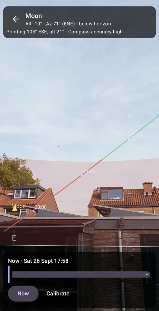
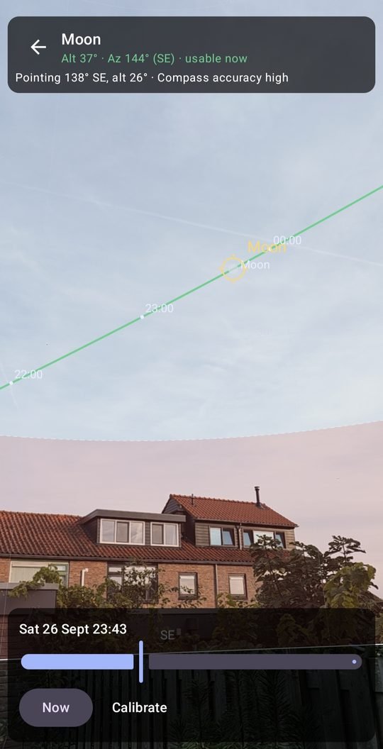
AR view: the Moon's path over the rooftops with hour ticks

See the path over your own sky

Point your phone at the sky: the camera shows your real surroundings, and SkyWindow draws the target's position and its whole path for the night on top, with hour ticks. You see straight away where it disappears behind the neighbour's roof and when it comes out again.

  • Green where the target is usable, red where your blocked sky hides it
  • Scrub through the night with the time slider
  • Gyro-stabilised heading, with a warning when metal nearby disturbs the compass
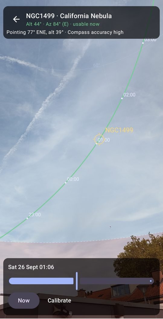
AR view: the California Nebula's path across the evening skyAR view: red where the path runs behind blocked sky

Plan with your real horizon

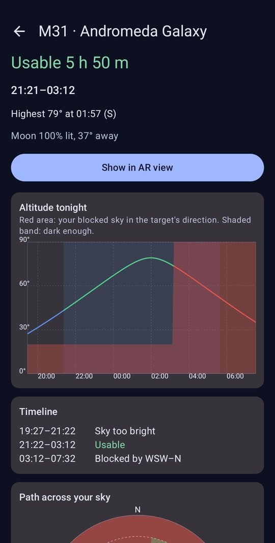
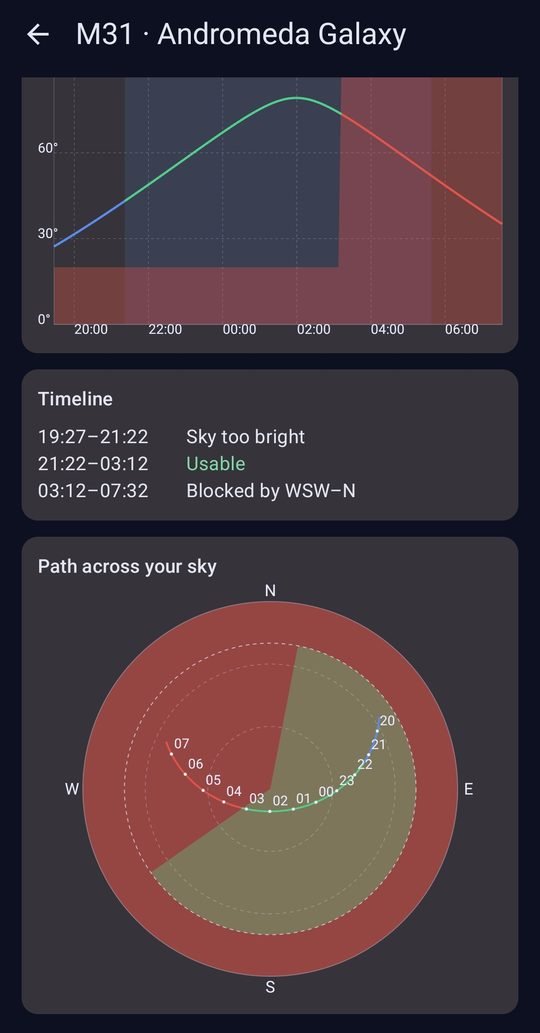
Mark the directions that are blocked in seconds: tap the compass, drag the edges, or point the camera at the edge of a roof and tap Set start here. SkyWindow then works out the usable windows for every target: "M31: usable 5 h 50 m, 21:21–03:12", and why it isn't usable the rest of the night.

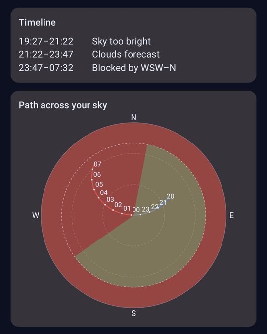
  • Altitude chart against your blocked sky, and a 360° sky map with the path
  • Several locations (home, allotment, holiday cabin), compared side by side
  • Messier, bright NGC/IC objects, the Moon and planets
Andromeda Galaxy: usable 5 h 50 m with altitude chart and timeline360° sky map with blocked directions and the target's path

Made for smart telescopes

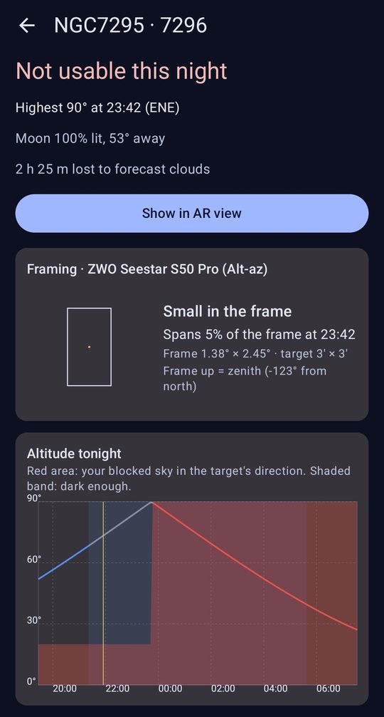
Choose your ZWO Seestar S30, S30 Pro, S50, S50 Pro or DWARFLAB DWARF mini, DWARF 3 or DRACO. SkyWindow checks how each target fits the camera frame, in alt-az mode (the field slowly rotates during the night) or EQ mode, and suggests tonight's best targets for your setup.

  • Optional hour-by-hour cloud forecast: see which clear hours are left
  • Moon phase and distance, minimum altitude for your telescope
  • Red night mode to protect your dark adaptation
Framing for a Seestar S50 Pro and time lost to forecast cloudsAltitude chart against the blocked sky, with the path on the sky map

Your sky, your data

No account, no ads, no tracking. Your locations stay on your phone. Only if you switch on the optional cloud forecast are rounded coordinates (about 1 km) sent to the weather service Open-Meteo. Read the privacy policy.

Coming soon to Google Play